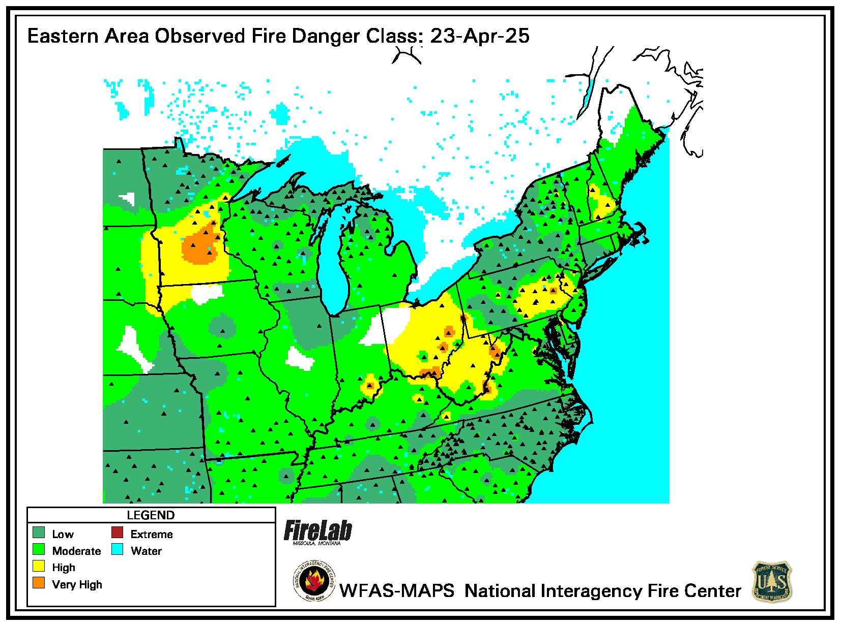
Fire Danger Today
Only reporting station locations are indicated with a marker on the maps. Values between stations are estimated with an inverse distance-squared technique on a 10-km grid. This works pretty well in areas of relatively high station density, but has obvious shortcomings in other areas.